TRACK 2, DAY 2
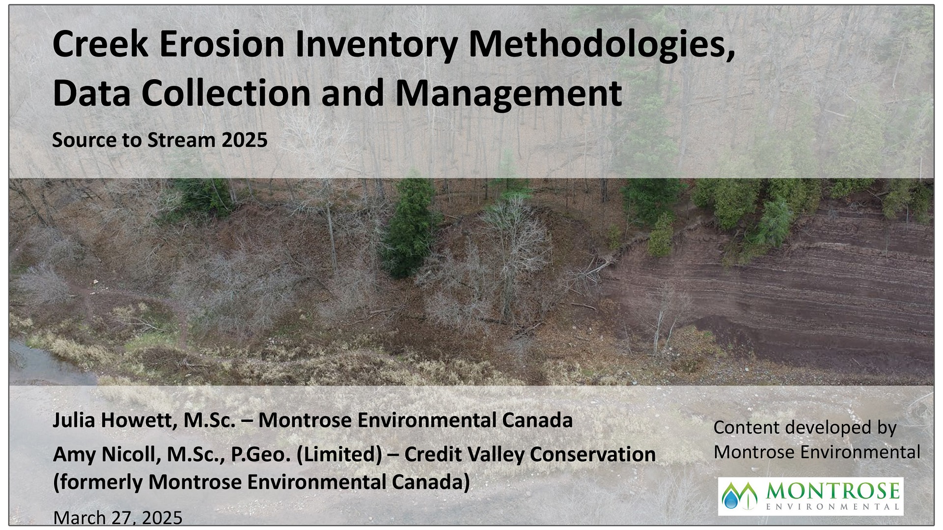
Creek Erosion Inventories: Methodologies for Risk Assessment and Prioritization
ABSTRACT
Creek erosion inventories are used to manage channel erosion risks to infrastructure, property, and public health and safety over expansive areas.
Goals of such studies focus on documenting the resilience of watercourses and municipal assets to erosion, and opportunities to protect, restore and enhance conditions.
Topics considered in this presentation include:
Scale: Spatial and temporal scales of creek erosion inventories vary; such scales are important considerations at the onset of these projects.
Framework: Erosion risk probability is evaluated through assessment of the likelihood of asset exposure to erosion hazards; and severity is evaluated as the relative consequence of erosion to impacted property, people, and/or infrastructure.
Data Collection: Identification of key parameters to inventory and associate data attributes should allow for both static (i.e., required data collected every iteration) and dynamic (forms to allow for flexibility of various inventory items).
Resources: Data collection platforms and staffing/training considerations are discussed.
Applications: Creek erosion inventories can be completed as an independent erosion assessment, or can be completed within an EA or Master Plan framework, or be integrated into other City initiatives and stormwater management plans.
Completion of erosion inventories along watercourses offers an opportunity to shift from a reactive management approach, in which emergency works are identified and mitigated, to a proactive management approach that allows monitoring of lower priority sites.
Results provide an overview of the “state” of a watershed, and can be developed into “living” databases that are updated to document watershed change over time.
ABOUT THE PRESENTERS

Amy Nicoll, Credit Valley Conservation (CVC)
Amy Nicoll is a fluvial geomorphologist with Matrix Solutions and has over twelve years of consulting experience in Ontario. She holds a M.Sc. in physical geography and a B.Sc. in Earth Science.
Ms. Nicoll has been involved in channel assessment and design projects from initial investigations to the construction stage and has worked closely with other specialists to achieve interdisciplinary design objectives.
Heather has worked on stream restoration and assessment projects across Canada and in the US.
Julia Howett, Montrose Environmental
Julia Howett is a fluvial geomorphology specialist with Matrix Solutions. She holds a M.Sc. in physical geography. She has over eight years if experience with water resources related fluvial geomorphic investigations, erosion inventories, monitoring, and natural channel restoration design.